|
|
geology
The first European to sight Maria Island was Abel Tasman in December 1642. It was Tasman who, having named the main island after Anthony Van Diemen, the Governor-in-Chief of the Dutch East India Company in Batavia, named this small east coast island, Maria, after the Governor-in-Chief's wife. The first Englishman to land on the island was Captain John Cox who arrived in 1789, anchored at Shoal Bay, and made contact with the local Aborigines. Three years later the French explorer, Nicholas Baudin, spent five days investigating the island. The diversity of these early explorers is summed up by the variety of names given to the coastline - everything from Ile du Nord to Chinaman's Bay, Mistaken Cape and Cape Boulanger. The island has experienced four distinct periods of European settlement. The first 'settlers' were whalers and sealers who lived a hard and temporary life on the island in the early nineteenth century. They viciously exploited the local Aborigines while plundered [sic] the local seal population. In 1825 the sealers gave way to a penal colony (the second to be established in Van Diemen's Land) established by Governor George Arthur to ease the ever-increasing pressure on Hobart Town. Arthur sent 50 convicts, accompanied by a superintendent and a small party of soldiers, to the island. Although their stay was relatively short (the colony closed in 1832 after the larger prison at Port Arthur was established) they built a number of buildings of which only the Commissariat Store and the prisoner's barracks, known as the Penitentiary, still stand. Located at Darlington they were built of local stones and bricks. Both buildings have a solidity which makes them look as though they will survive for another thousand years. At this time the island was leased to Charles Seal but, when the number of convicts arriving in Van Diemen's Land dramatically increased in the early 1840s, Lieutenant-Governor Franklin repaired the original buildings and reopened the island as a penal colony. The second period of convict settlement started in 1842 and it was during this period that the island's population expanded dramatically. A second convict station was established at Point Lesueur, over 800 convicts arrived on the island, and an extensive building program was commenced. Again the settlement was
short-lived. It was abandoned for the last time in 1851 and a few farmers arrived
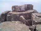
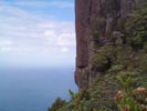
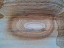
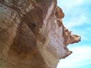
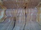
to take advantage of the good sheep pastures and the mild climate. So enthusiastic was Bernacchi that he attracted a State School (now used as the Ranger's office), general store, butcher and baker to the island. The project failed and Bernacchi abandoned the island around 1895. Undeterred he returned in 1920 to build a pier and railway line to exploit the island's deposits of cement. Like every other activity on the island, the cement works was short-lived. By 1930 the cement works lay silent and the farmers had, once again, quietly assumed economic preeminence. In 1972 the whole island became a National Park. Maria Island is located 88 km northeast of Hobart via the Tasman Highway. Source: http://www.walkabout.com.au/locations/TASMariaIsland.shtml#Things%20to%20see ------ "If this interpretation is correct, Tasmania and much of the area now beneath the Bass Basin and central Victoria may have remained as an isolated fragment of continental crust, with new oceans forming on either side. During the early Devonian this fragment was involved in a collision along it's western margin...[in] the middle Devonian a collision occurred on it's eastern margin...The deformation resulting...is preserved in a collage of folds, thrusts, reverse faults and strike slip faults...related is a period of extensive granite intrusion.[1]" Aboriginal people first traveled to Maria Island via canoe; in the early 1800's, whalers and sealers visited, with deleterious effects on human and animal populations. Then came the first of two waves of convict settlement, followed in the 1920's by expansion into concrete making; the dreams of Bernacchi would not be realised and by the 1950's there were mostly farms. In 1972, the island was declared a national park. Very much a collage of folds, thrusts and reverse faults as the tide of humanity waxed and waned (two convict settlements, Bernacchi tried twice to revive the economy, to no avail). Extensive granite intrusion sounds a lot like colonialism to us. [1]. Hall, M (1998). The structural history of northern Tasmania and the Bass Strait connection. Available http://www.agcrc.csiro.au/publications/9798/335.html 3rd January 2002. ------ The strange rock formations and patterns in the photos above are of the 'painted rocks', an attraction on Maria Island. ------
|

